Canada Topographic Maps

Blanche River Topo Maps

Topography maps and Latitude/Longitude Location

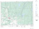
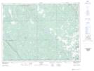
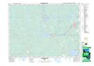
Maps showing Blanche River, Timiskaming, Ontario

Blanche River is a River located in Timiskaming, Ontario and has an elevation of 170 meters.

  • Latitude: 47° 33' 40'' North   (decimal: 47.5611111)
  • Longitude: 79° 32' 1'' West   (decimal: -79.5336111)
  • Topography Feature Category: River
  • Geographical Feature: River
  • Canadian Province/Territory: Ontario
  • Elevation: 170 meters
  • Location: Timiskaming
  • Atlas of Canada Locator Map: Blanche River
  • GPS Coordinate Locator Map: Blanche River Lat/Long

Blanche River NTS Map Sheets

031M12 New Liskeard Topographic Map at 1:50,000 scale

031M13 Englehart Topographic Map at 1:50,000 scale

041P16 Charlton Topographic Map at 1:50,000 scale

042A01 Kirkland Lake Topographic Map at 1:50,000 scale

031M Ville-Marie Topographic Map at 1:250,000 scale

041P Gogama Topographic Map at 1:250,000 scale

042A Timmins Topographic Map at 1:250,000 scale

 
Buy Topographic Maps DVD
Newsletter Sign-up

Yes, I want to receive map store discounts.


Bookmark and Share