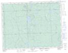
Maps showing Boyle Creek, Cochrane, Ontario
Boyle Creek is a River located in Cochrane, Ontario and has an elevation of 249 meters.
- Latitude: 49° 39' 28'' North (decimal: 49.6577777)
- Longitude: 84° 7' 35'' West (decimal: -84.1263888)
- Topography Feature Category: River
- Geographical Feature: Creek
- Canadian Province/Territory: Ontario
- Elevation: 249 meters
- Location: Cochrane
- Atlas of Canada Locator Map: Boyle Creek
- GPS Coordinate Locator Map: Boyle Creek Lat/Long
Boyle Creek NTS Map Sheets