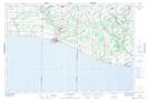
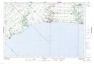
Maps showing Bradleys Creek, Elgin, Ontario
Bradleys Creek is a River located in Elgin, Ontario and has an elevation of 229 meters.
- Latitude: 42° 44' 36'' North (decimal: 42.7433333)
- Longitude: 81° 3' 11'' West (decimal: -81.0530555)
- Topography Feature Category: River
- Geographical Feature: Creek
- Canadian Province/Territory: Ontario
- Elevation: 229 meters
- Location: Elgin
- Atlas of Canada Locator Map: Bradleys Creek
- GPS Coordinate Locator Map: Bradleys Creek Lat/Long
Bradleys Creek NTS Map Sheets