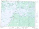
Maps showing Brûlé Island, Rainy River, Ontario
Brûlé Island is a Island located in Rainy River, Ontario and has an elevation of 334 meters.
- Latitude: 49° 7' 37'' North (decimal: 49.1269444)
- Longitude: 94° 19' 27'' West (decimal: -94.3241666)
- Topography Feature Category: Island
- Geographical Feature: Island
- Canadian Province/Territory: Ontario
- Elevation: 334 meters
- Location: Rainy River
- Atlas of Canada Locator Map: Brûlé Island
- GPS Coordinate Locator Map: Brûlé Island Lat/Long