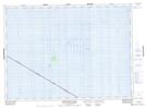
Maps showing Caribou Island, Thunder Bay, Ontario
Caribou Island is a Island located in Thunder Bay, Ontario and has an elevation of 183 meters.
- Latitude: 47° 21' 36'' North (decimal: 47.3600000)
- Longitude: 85° 48' 34'' West (decimal: -85.8094444)
- Topography Feature Category: Island
- Geographical Feature: Island
- Canadian Province/Territory: Ontario
- Elevation: 183 meters
- Location: Thunder Bay
- Atlas of Canada Locator Map: Caribou Island
- GPS Coordinate Locator Map: Caribou Island Lat/Long
Caribou Island NTS Map Sheets