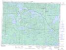
Maps showing Chaplin River, Sudbury, Ontario
Chaplin River is a River located in Sudbury, Ontario and has an elevation of 362 meters.
- Latitude: 48° 11' 27'' North (decimal: 48.1908333)
- Longitude: 83° 33' 21'' West (decimal: -83.5558333)
- Topography Feature Category: River
- Geographical Feature: River
- Canadian Province/Territory: Ontario
- Elevation: 362 meters
- Location: Sudbury
- Atlas of Canada Locator Map: Chaplin River
- GPS Coordinate Locator Map: Chaplin River Lat/Long
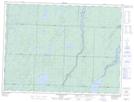
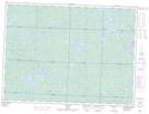
Chaplin River NTS Map Sheets