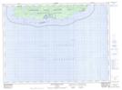
Maps showing Cotton Cove, Thunder Bay, Ontario
Cotton Cove is a Bay located in Thunder Bay, Ontario and has an elevation of 192 meters.
- Latitude: 47° 43' 29'' North (decimal: 47.7247222)
- Longitude: 85° 57' 13'' West (decimal: -85.9536111)
- Topography Feature Category: Bay
- Geographical Feature: Cove
- Canadian Province/Territory: Ontario
- Elevation: 192 meters
- Location: Thunder Bay
- Atlas of Canada Locator Map: Cotton Cove
- GPS Coordinate Locator Map: Cotton Cove Lat/Long
Cotton Cove NTS Map Sheets