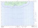
Maps showing Deer Yard, Thunder Bay, Ontario
Deer Yard is a Forest located in Thunder Bay, Ontario.
- Latitude: 47° 44' 37'' North (decimal: 47.7436111)
- Longitude: 85° 56' 20'' West (decimal: -85.9388888)
- Topography Feature Category: Forest
- Geographical Feature: Woods
- Canadian Province/Territory: Ontario
- Location: Thunder Bay
- Atlas of Canada Locator Map: Deer Yard
- GPS Coordinate Locator Map: Deer Yard Lat/Long
Deer Yard NTS Map Sheets