Maps showing Eber Pond, Algoma, Ontario
Eber Pond is a Lake located in Algoma, Ontario.
- Latitude: 47° 26' 54'' North (decimal: 47.4483333)
- Longitude: 84° 30' 11'' West (decimal: -84.5030555)
- Topography Feature Category: Lake
- Geographical Feature: Pond
- Canadian Province/Territory: Ontario
- Location: Algoma
- Atlas of Canada Locator Map: Eber Pond
- GPS Coordinate Locator Map: Eber Pond Lat/Long
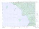
Eber Pond NTS Map Sheets