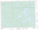
Maps showing Forget Portage, Algoma, Ontario
Forget Portage is a Road feature located in Algoma, Ontario and has an elevation of 361 meters.
- Latitude: 49° 13' 8'' North (decimal: 49.2188888)
- Longitude: 85° 3' 38'' West (decimal: -85.0605555)
- Topography Feature Category: Road feature
- Geographical Feature: Portage
- Canadian Province/Territory: Ontario
- Elevation: 361 meters
- Location: Algoma
- Atlas of Canada Locator Map: Forget Portage
- GPS Coordinate Locator Map: Forget Portage Lat/Long
Forget Portage NTS Map Sheets