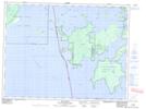
Maps showing Foster Reef, Kenora, Ontario
Foster Reef is a Shoal located in Kenora, Ontario and has an elevation of 332 meters.
- Latitude: 49° 4' 29'' North (decimal: 49.0747222)
- Longitude: 94° 38' 10'' West (decimal: -94.6361111)
- Topography Feature Category: Shoal
- Geographical Feature: Reef
- Canadian Province/Territory: Ontario
- Elevation: 332 meters
- Location: Kenora
- Atlas of Canada Locator Map: Foster Reef
- GPS Coordinate Locator Map: Foster Reef Lat/Long