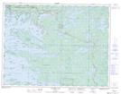
Maps showing The Funnel, Kenora, Ontario
The Funnel is a Channel located in Kenora, Ontario and has an elevation of 334 meters.
- Latitude: 49° 33' 29'' North (decimal: 49.5580555)
- Longitude: 94° 21' 33'' West (decimal: -94.3591666)
- Topography Feature Category: Channel
- Geographical Feature: Channel
- Canadian Province/Territory: Ontario
- Elevation: 334 meters
- Location: Kenora
- Atlas of Canada Locator Map: The Funnel
- GPS Coordinate Locator Map: The Funnel Lat/Long
The Funnel NTS Map Sheets