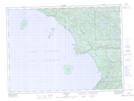
Maps showing Ganley Rock, Algoma, Ontario
Ganley Rock is a Shoal located in Algoma, Ontario.
- Latitude: 47° 24' 58'' North (decimal: 47.4161111)
- Longitude: 84° 45' 42'' West (decimal: -84.7616666)
- Topography Feature Category: Shoal
- Geographical Feature: Rock
- Canadian Province/Territory: Ontario
- Location: Algoma
- Atlas of Canada Locator Map: Ganley Rock
- GPS Coordinate Locator Map: Ganley Rock Lat/Long
Ganley Rock NTS Map Sheets