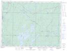
Maps showing Groundhog River, Sudbury, Ontario
Groundhog River is a Unincorporated area located in Sudbury, Ontario and has an elevation of 339 meters.
- Latitude: 48° 8' 24'' North (decimal: 48.1400000)
- Longitude: 82° 13' 36'' West (decimal: -82.2266666)
- Topography Feature Category: Unincorporated area
- Geographical Feature: Railway Point
- Canadian Province/Territory: Ontario
- Elevation: 339 meters
- Location: Sudbury
- Atlas of Canada Locator Map: Groundhog River
- GPS Coordinate Locator Map: Groundhog River Lat/Long