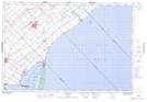
Maps showing Guilds, Kent, Ontario
Guilds is a Unincorporated area located in Kent, Ontario and has an elevation of 188 meters.
- Latitude: 42° 20' 42'' North (decimal: 42.3450000)
- Longitude: 81° 55' 14'' West (decimal: -81.9205555)
- Topography Feature Category: Unincorporated area
- Geographical Feature: Dispersed Rural Community
- Canadian Province/Territory: Ontario
- Elevation: 188 meters
- Location: Kent
- Atlas of Canada Locator Map: Guilds
- GPS Coordinate Locator Map: Guilds Lat/Long