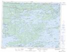
Maps showing Gull Rock Reef, Kenora, Ontario
Gull Rock Reef is a Shoal located in Kenora, Ontario.
- Latitude: 49° 43' 48'' North (decimal: 49.7300000)
- Longitude: 94° 32' 22'' West (decimal: -94.5394444)
- Topography Feature Category: Shoal
- Geographical Feature: Reef
- Canadian Province/Territory: Ontario
- Location: Kenora
- Atlas of Canada Locator Map: Gull Rock Reef
- GPS Coordinate Locator Map: Gull Rock Reef Lat/Long
Gull Rock Reef NTS Map Sheets