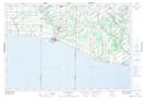
Maps showing Hahn Marsh, Norfolk, Ontario
Hahn Marsh is a Low vegetation located in Norfolk, Ontario and has an elevation of 178 meters.
- Latitude: 42° 34' 39'' North (decimal: 42.5774999)
- Longitude: 80° 31' 17'' West (decimal: -80.5213888)
- Topography Feature Category: Low vegetation
- Geographical Feature: Marsh
- Canadian Province/Territory: Ontario
- Elevation: 178 meters
- Location: Norfolk
- Atlas of Canada Locator Map: Hahn Marsh
- GPS Coordinate Locator Map: Hahn Marsh Lat/Long