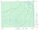
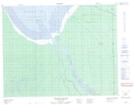
Maps showing Harricanaw River, Cochrane, Ontario
Harricanaw River is a River located in Cochrane, Ontario and has an elevation of 12 meters.
- Latitude: 51° 10' 41'' North (decimal: 51.1780555)
- Longitude: 79° 45' 14'' West (decimal: -79.7538888)
- Topography Feature Category: River
- Geographical Feature: River
- Canadian Province/Territory: Ontario
- Elevation: 12 meters
- Location: Cochrane
- Atlas of Canada Locator Map: Harricanaw River
- GPS Coordinate Locator Map: Harricanaw River Lat/Long
Harricanaw River NTS Map Sheets