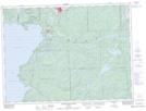
Maps showing High Falls, Algoma, Ontario
High Falls is a Falls located in Algoma, Ontario.
- Latitude: 47° 54' 30'' North (decimal: 47.9083333)
- Longitude: 84° 42' 48'' West (decimal: -84.7133333)
- Topography Feature Category: Falls
- Geographical Feature: Falls
- Canadian Province/Territory: Ontario
- Location: Algoma
- Atlas of Canada Locator Map: High Falls
- GPS Coordinate Locator Map: High Falls Lat/Long
High Falls NTS Map Sheets