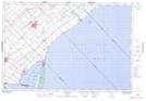
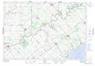
Maps showing Highgate, Kent, Ontario
Highgate is a Unincorporated area located in Kent, Ontario and has an elevation of 215 meters.
- Latitude: 42° 30' 4'' North (decimal: 42.5011111)
- Longitude: 81° 48' 55'' West (decimal: -81.8152777)
- Topography Feature Category: Unincorporated area
- Geographical Feature: Community
- Canadian Province/Territory: Ontario
- Elevation: 215 meters
- Location: Kent
- Atlas of Canada Locator Map: Highgate
- GPS Coordinate Locator Map: Highgate Lat/Long
Highgate NTS Map Sheets