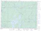
Maps showing Horwood Lake, Sudbury, Ontario
Horwood Lake is a Unincorporated area located in Sudbury, Ontario and has an elevation of 366 meters.
- Latitude: 48° 5' 10'' North (decimal: 48.0861111)
- Longitude: 82° 9' 34'' West (decimal: -82.1594444)
- Topography Feature Category: Unincorporated area
- Geographical Feature: Railway Point
- Canadian Province/Territory: Ontario
- Elevation: 366 meters
- Location: Sudbury
- Atlas of Canada Locator Map: Horwood Lake
- GPS Coordinate Locator Map: Horwood Lake Lat/Long