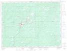
Maps showing Ice Cream Creek, Thunder Bay, Ontario
Ice Cream Creek is a River located in Thunder Bay, Ontario.
- Latitude: 49° 8' 56'' North (decimal: 49.1488888)
- Longitude: 85° 36' 29'' West (decimal: -85.6080555)
- Topography Feature Category: River
- Geographical Feature: Creek
- Canadian Province/Territory: Ontario
- Location: Thunder Bay
- Atlas of Canada Locator Map: Ice Cream Creek
- GPS Coordinate Locator Map: Ice Cream Creek Lat/Long
Ice Cream Creek NTS Map Sheets