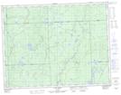
Maps showing Island Portage, Algoma, Ontario
Island Portage is a Road feature located in Algoma, Ontario and has an elevation of 285 meters.
- Latitude: 49° 24' 29'' North (decimal: 49.4080555)
- Longitude: 84° 28' 11'' West (decimal: -84.4697222)
- Topography Feature Category: Road feature
- Geographical Feature: Portage
- Canadian Province/Territory: Ontario
- Elevation: 285 meters
- Location: Algoma
- Atlas of Canada Locator Map: Island Portage
- GPS Coordinate Locator Map: Island Portage Lat/Long
Island Portage NTS Map Sheets