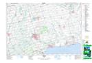
Maps showing Jarvis, Haldimand, Ontario
Jarvis is a Unincorporated area located in Haldimand, Ontario and has an elevation of 209 meters.
- Latitude: 42° 53' 10'' North (decimal: 42.8861111)
- Longitude: 80° 6' 46'' West (decimal: -80.1127777)
- Topography Feature Category: Unincorporated area
- Geographical Feature: Urban Community
- Canadian Province/Territory: Ontario
- Elevation: 209 meters
- Location: Haldimand
- Atlas of Canada Locator Map: Jarvis
- GPS Coordinate Locator Map: Jarvis Lat/Long