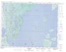
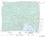
Maps showing Ken's Rock, Thunder Bay, Ontario
Ken's Rock is a Shoal located in Thunder Bay, Ontario.
- Latitude: 50° 0' 41'' North (decimal: 50.0113888)
- Longitude: 88° 50' 35'' West (decimal: -88.8430555)
- Topography Feature Category: Shoal
- Geographical Feature: Rock
- Canadian Province/Territory: Ontario
- Location: Thunder Bay
- Atlas of Canada Locator Map: Ken's Rock
- GPS Coordinate Locator Map: Ken's Rock Lat/Long
Ken's Rock NTS Map Sheets