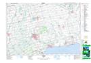
Maps showing Kitchen's Point, Norfolk, Ontario
Kitchen's Point is a Cape located in Norfolk, Ontario and has an elevation of 177 meters.
- Latitude: 42° 47' 12'' North (decimal: 42.7866666)
- Longitude: 80° 8' 24'' West (decimal: -80.1400000)
- Topography Feature Category: Cape
- Geographical Feature: Point
- Canadian Province/Territory: Ontario
- Elevation: 177 meters
- Location: Norfolk
- Atlas of Canada Locator Map: Kitchen's Point
- GPS Coordinate Locator Map: Kitchen's Point Lat/Long