Maps showing La Salette, Norfolk, Ontario
La Salette is a Unincorporated area located in Norfolk, Ontario and has an elevation of 232 meters.
- Latitude: 42° 54' 10'' North (decimal: 42.9027777)
- Longitude: 80° 30' 8'' West (decimal: -80.5022222)
- Topography Feature Category: Unincorporated area
- Geographical Feature: Dispersed Rural Community
- Canadian Province/Territory: Ontario
- Elevation: 232 meters
- Location: Norfolk
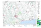
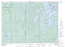
- Atlas of Canada Locator Map: La Salette
- GPS Coordinate Locator Map: La Salette Lat/Long
La Salette NTS Map Sheets