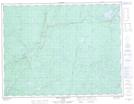
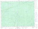
Maps showing Lauri Creek, Thunder Bay, Ontario
Lauri Creek is a River located in Thunder Bay, Ontario and has an elevation of 311 meters.
- Latitude: 49° 29' 15'' North (decimal: 49.4875000)
- Longitude: 85° 56' 42'' West (decimal: -85.9449999)
- Topography Feature Category: River
- Geographical Feature: Creek
- Canadian Province/Territory: Ontario
- Elevation: 311 meters
- Location: Thunder Bay
- Atlas of Canada Locator Map: Lauri Creek
- GPS Coordinate Locator Map: Lauri Creek Lat/Long
Lauri Creek NTS Map Sheets