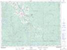
Maps showing Lavaflow Mountain, Cochrane, Ontario
Lavaflow Mountain is a Mountain located in Cochrane, Ontario and has an elevation of 325 meters.
- Latitude: 48° 25' 38'' North (decimal: 48.4272222)
- Longitude: 80° 14' 28'' West (decimal: -80.2411111)
- Topography Feature Category: Mountain
- Geographical Feature: Mountain
- Canadian Province/Territory: Ontario
- Elevation: 325 meters
- Location: Cochrane
- Atlas of Canada Locator Map: Lavaflow Mountain
- GPS Coordinate Locator Map: Lavaflow Mountain Lat/Long