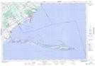
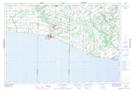
Maps showing Lee Brown Marsh, Norfolk, Ontario
Lee Brown Marsh is a Low vegetation located in Norfolk, Ontario and has an elevation of 175 meters.
- Latitude: 42° 34' 51'' North (decimal: 42.5808333)
- Longitude: 80° 30' 2'' West (decimal: -80.5005555)
- Topography Feature Category: Low vegetation
- Geographical Feature: Marsh
- Canadian Province/Territory: Ontario
- Elevation: 175 meters
- Location: Norfolk
- Atlas of Canada Locator Map: Lee Brown Marsh
- GPS Coordinate Locator Map: Lee Brown Marsh Lat/Long
Lee Brown Marsh NTS Map Sheets