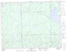
Maps showing Leigh, Thunder Bay, Ontario
Leigh is a Unincorporated area located in Thunder Bay, Ontario and has an elevation of 329 meters.
- Latitude: 49° 22' 37'' North (decimal: 49.3769444)
- Longitude: 85° 13' 14'' West (decimal: -85.2205555)
- Topography Feature Category: Unincorporated area
- Geographical Feature: Railway Point
- Canadian Province/Territory: Ontario
- Elevation: 329 meters
- Location: Thunder Bay
- Atlas of Canada Locator Map: Leigh
- GPS Coordinate Locator Map: Leigh Lat/Long
Leigh NTS Map Sheets