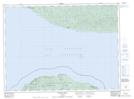
Maps showing Le Petit Mort Rocks, Thunder Bay, Ontario
Le Petit Mort Rocks is a Shoal located in Thunder Bay, Ontario and has an elevation of 193 meters.
- Latitude: 47° 55' 29'' North (decimal: 47.9247222)
- Longitude: 85° 40' 34'' West (decimal: -85.6761111)
- Topography Feature Category: Shoal
- Geographical Feature: Rocks
- Canadian Province/Territory: Ontario
- Elevation: 193 meters
- Location: Thunder Bay
- Atlas of Canada Locator Map: Le Petit Mort Rocks
- GPS Coordinate Locator Map: Le Petit Mort Rocks Lat/Long
Le Petit Mort Rocks NTS Map Sheets