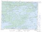
Maps showing Lily Pad Bay, Kenora, Ontario
Lily Pad Bay is a Bay located in Kenora, Ontario and has an elevation of 334 meters.
- Latitude: 49° 42' 52'' North (decimal: 49.7144444)
- Longitude: 94° 33' 11'' West (decimal: -94.5530555)
- Topography Feature Category: Bay
- Geographical Feature: Bay
- Canadian Province/Territory: Ontario
- Elevation: 334 meters
- Location: Kenora
- Atlas of Canada Locator Map: Lily Pad Bay
- GPS Coordinate Locator Map: Lily Pad Bay Lat/Long
Lily Pad Bay NTS Map Sheets