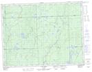
Maps showing Little Dowsley Lake, Algoma, Ontario
Little Dowsley Lake is a Lake located in Algoma, Ontario and has an elevation of 311 meters.
- Latitude: 49° 21' 59'' North (decimal: 49.3663888)
- Longitude: 84° 22' 19'' West (decimal: -84.3719444)
- Topography Feature Category: Lake
- Geographical Feature: Lake
- Canadian Province/Territory: Ontario
- Elevation: 311 meters
- Location: Algoma
- Atlas of Canada Locator Map: Little Dowsley Lake
- GPS Coordinate Locator Map: Little Dowsley Lake Lat/Long
Little Dowsley Lake NTS Map Sheets