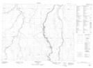
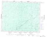
Maps showing Little Long Rapids, Cochrane, Ontario
Little Long Rapids is a Unincorporated area located in Cochrane, Ontario.
- Latitude: 50° 0' 16'' North (decimal: 50.0044444)
- Longitude: 82° 10' 6'' West (decimal: -82.1683333)
- Topography Feature Category: Unincorporated area
- Geographical Feature: Dispersed Rural Community
- Canadian Province/Territory: Ontario
- Location: Cochrane
- Atlas of Canada Locator Map: Little Long Rapids
- GPS Coordinate Locator Map: Little Long Rapids Lat/Long
Little Long Rapids NTS Map Sheets