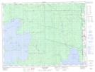
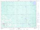
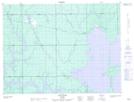
Maps showing Long Point, Cochrane, Ontario
Long Point is a Cape located in Cochrane, Ontario and has an elevation of 274 meters.
- Latitude: 48° 48' 52'' North (decimal: 48.8144443)
- Longitude: 80° 1' 36'' West (decimal: -80.0266665)
- Topography Feature Category: Cape
- Geographical Feature: Point
- Canadian Province/Territory: Ontario
- Elevation: 274 meters
- Location: Cochrane
- Atlas of Canada Locator Map: Long Point
- GPS Coordinate Locator Map: Long Point Lat/Long
Long Point NTS Map Sheets