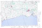
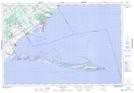
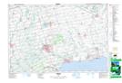
Maps showing Long Point Bay, Norfolk, Ontario
Long Point Bay is a Bay located in Norfolk, Ontario and has an elevation of 173 meters.
- Latitude: 42° 40' 35'' North (decimal: 42.6763888)
- Longitude: 80° 9' 28'' West (decimal: -80.1577777)
- Topography Feature Category: Bay
- Geographical Feature: Bay
- Canadian Province/Territory: Ontario
- Elevation: 173 meters
- Location: Norfolk
- Atlas of Canada Locator Map: Long Point Bay
- GPS Coordinate Locator Map: Long Point Bay Lat/Long
Long Point Bay NTS Map Sheets