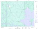
Maps showing Low Bush, Cochrane, Ontario
Low Bush is a Unincorporated area located in Cochrane, Ontario and has an elevation of 273 meters.
- Latitude: 48° 55' 12'' North (decimal: 48.9199999)
- Longitude: 80° 8' 24'' West (decimal: -80.1400000)
- Topography Feature Category: Unincorporated area
- Geographical Feature: Railway Point
- Canadian Province/Territory: Ontario
- Elevation: 273 meters
- Location: Cochrane
- Atlas of Canada Locator Map: Low Bush
- GPS Coordinate Locator Map: Low Bush Lat/Long