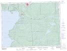
Maps showing Mackey Point, Algoma, Ontario
Mackey Point is a Cape located in Algoma, Ontario.
- Latitude: 48° 0' 1'' North (decimal: 48.0002777)
- Longitude: 84° 44' 33'' West (decimal: -84.7424999)
- Topography Feature Category: Cape
- Geographical Feature: Point
- Canadian Province/Territory: Ontario
- Location: Algoma
- Atlas of Canada Locator Map: Mackey Point
- GPS Coordinate Locator Map: Mackey Point Lat/Long
Mackey Point NTS Map Sheets