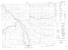
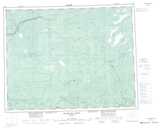
Maps showing Mammamattawa, Cochrane, Ontario
Mammamattawa is a Unincorporated area located in Cochrane, Ontario and has an elevation of 90 meters.
- Latitude: 50° 24' 46'' North (decimal: 50.4127777)
- Longitude: 84° 22' 4'' West (decimal: -84.3677777)
- Topography Feature Category: Unincorporated area
- Geographical Feature: Dispersed Rural Community
- Canadian Province/Territory: Ontario
- Elevation: 90 meters
- Location: Cochrane
- Atlas of Canada Locator Map: Mammamattawa
- GPS Coordinate Locator Map: Mammamattawa Lat/Long
Mammamattawa NTS Map Sheets