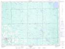
Maps showing McCool Hill, Cochrane, Ontario
McCool Hill is a Mountain located in Cochrane, Ontario and has an elevation of 360 meters.
- Latitude: 48° 33' 46'' North (decimal: 48.5627777)
- Longitude: 80° 5' 5'' West (decimal: -80.0847222)
- Topography Feature Category: Mountain
- Geographical Feature: Hill
- Canadian Province/Territory: Ontario
- Elevation: 360 meters
- Location: Cochrane
- Atlas of Canada Locator Map: McCool Hill
- GPS Coordinate Locator Map: McCool Hill Lat/Long