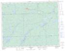
Maps showing Morrison River Landing, Algoma, Ontario
Morrison River Landing is a Unincorporated area located in Algoma, Ontario.
- Latitude: 49° 11' 50'' North (decimal: 49.1972222)
- Longitude: 84° 32' 30'' West (decimal: -84.5416666)
- Topography Feature Category: Unincorporated area
- Geographical Feature: Locality
- Canadian Province/Territory: Ontario
- Location: Algoma
- Atlas of Canada Locator Map: Morrison River Landing
- GPS Coordinate Locator Map: Morrison River Landing Lat/Long
Morrison River Landing NTS Map Sheets