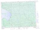
Maps showing O'Connor Creek, Algoma, Ontario
O'Connor Creek is a River located in Algoma, Ontario and has an elevation of 503 meters.
- Latitude: 47° 0' 36'' North (decimal: 47.0100000)
- Longitude: 84° 7' 22'' West (decimal: -84.1227777)
- Topography Feature Category: River
- Geographical Feature: Creek
- Canadian Province/Territory: Ontario
- Elevation: 503 meters
- Location: Algoma
- Atlas of Canada Locator Map: O'Connor Creek
- GPS Coordinate Locator Map: O'Connor Creek Lat/Long
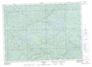
O'Connor Creek NTS Map Sheets