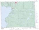
Maps showing Old Woman River, Algoma, Ontario
Old Woman River is a River located in Algoma, Ontario and has an elevation of 207 meters.
- Latitude: 47° 47' 8'' North (decimal: 47.7855555)
- Longitude: 84° 53' 45'' West (decimal: -84.8958333)
- Topography Feature Category: River
- Geographical Feature: River
- Canadian Province/Territory: Ontario
- Elevation: 207 meters
- Location: Algoma
- Atlas of Canada Locator Map: Old Woman River
- GPS Coordinate Locator Map: Old Woman River Lat/Long
Old Woman River NTS Map Sheets