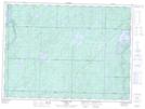
Maps showing Paul Creek, Sudbury, Ontario
Paul Creek is a River located in Sudbury, Ontario and has an elevation of 339 meters.
- Latitude: 48° 9' 49'' North (decimal: 48.1636111)
- Longitude: 82° 57' 30'' West (decimal: -82.9583333)
- Topography Feature Category: River
- Geographical Feature: Creek
- Canadian Province/Territory: Ontario
- Elevation: 339 meters
- Location: Sudbury
- Atlas of Canada Locator Map: Paul Creek
- GPS Coordinate Locator Map: Paul Creek Lat/Long
Paul Creek NTS Map Sheets