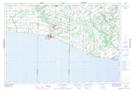
Maps showing Port Burwell, Elgin, Ontario
Port Burwell is a Unincorporated area located in Elgin, Ontario and has an elevation of 180 meters.
- Latitude: 42° 38' 52'' North (decimal: 42.6477777)
- Longitude: 80° 48' 13'' West (decimal: -80.8036111)
- Topography Feature Category: Unincorporated area
- Geographical Feature: Community
- Canadian Province/Territory: Ontario
- Elevation: 180 meters
- Location: Elgin
- Atlas of Canada Locator Map: Port Burwell
- GPS Coordinate Locator Map: Port Burwell Lat/Long