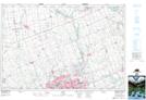
Maps showing Pottersburg, Middlesex, Ontario
Pottersburg is a Unincorporated area located in Middlesex, Ontario and has an elevation of 260 meters.
- Latitude: 42° 59' 53'' North (decimal: 42.9980555)
- Longitude: 81° 10' 50'' West (decimal: -81.1805555)
- Topography Feature Category: Unincorporated area
- Geographical Feature: Urban Community
- Canadian Province/Territory: Ontario
- Elevation: 260 meters
- Location: Middlesex
- Atlas of Canada Locator Map: Pottersburg
- GPS Coordinate Locator Map: Pottersburg Lat/Long
Pottersburg NTS Map Sheets