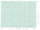
Maps showing Red Pine Point, Timiskaming, Ontario
Red Pine Point is a Cape located in Timiskaming, Ontario.
- Latitude: 48° 6' 54'' North (decimal: 48.1150000)
- Longitude: 81° 32' 22'' West (decimal: -81.5394444)
- Topography Feature Category: Cape
- Geographical Feature: Point
- Canadian Province/Territory: Ontario
- Location: Timiskaming
- Atlas of Canada Locator Map: Red Pine Point
- GPS Coordinate Locator Map: Red Pine Point Lat/Long
Red Pine Point NTS Map Sheets