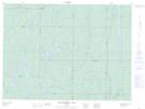
Maps showing Red Sucker Lake, Sudbury, Ontario
Red Sucker Lake is a Lake located in Sudbury, Ontario.
- Latitude: 48° 2' 40'' North (decimal: 48.0444444)
- Longitude: 81° 36' 49'' West (decimal: -81.6136111)
- Topography Feature Category: Lake
- Geographical Feature: Lake
- Canadian Province/Territory: Ontario
- Location: Sudbury
- Atlas of Canada Locator Map: Red Sucker Lake
- GPS Coordinate Locator Map: Red Sucker Lake Lat/Long
Red Sucker Lake NTS Map Sheets