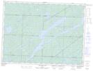
Maps showing Renabie, Sudbury, Ontario
Renabie is a Other municipal/district area - miscellaneous located in Sudbury, Ontario.
- Latitude: 48° 21' North (decimal: 48.3499999)
- Longitude: 83° 51' West (decimal: -83.8500000)
- Topography Feature Category: Other municipal/district area - miscellaneous
- Geographical Feature: Improvement District
- Canadian Province/Territory: Ontario
- Location: Sudbury
- GPS Coordinate Locator Map: Renabie Lat/Long
Renabie NTS Map Sheets